トップページ > 製品・システム案内 > 海洋版GIS Marine Explorer
海洋版GISMarine Explorer
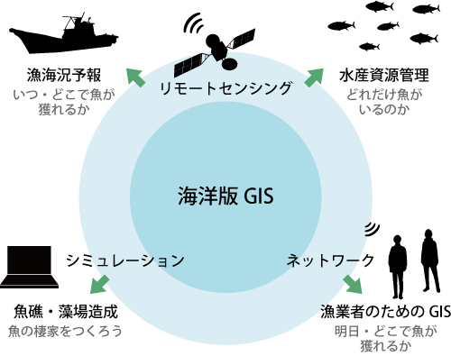
Marine Explorerの活用分野及び詳細情報
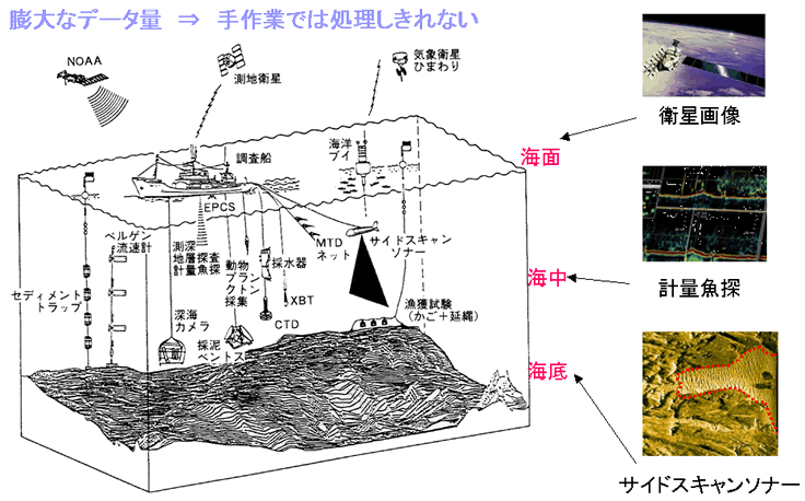
調査船等の観測データ処理
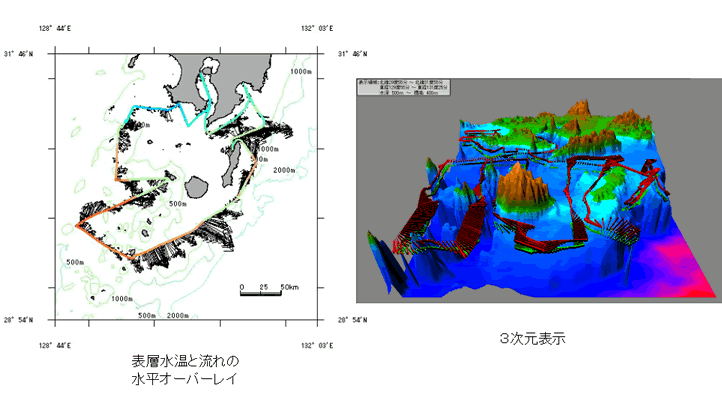
海洋版GISとリモートセンシング
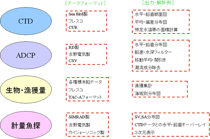
Marine Explorerで処理できる観測データ
調査船データの即日処理
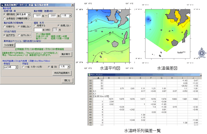
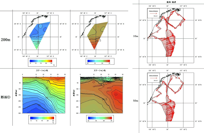
定線観測データと連携した平均・偏差図の作成
流れデータ
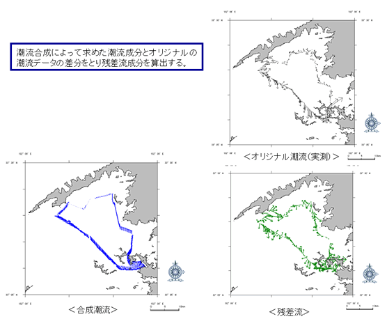
残差流算出機能
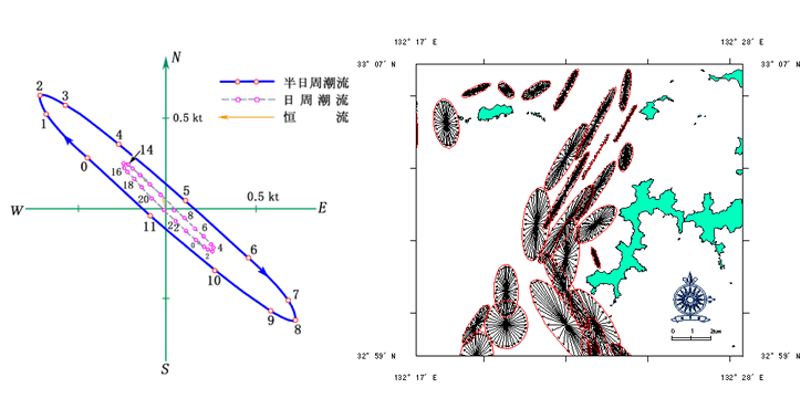
潮流楕円によるデータ検証
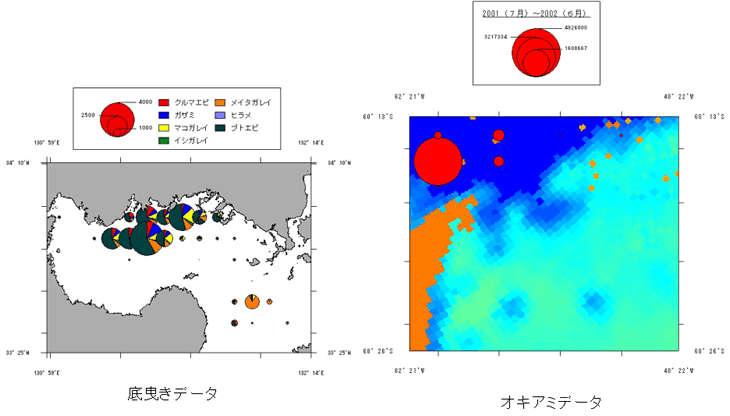
生物・漁獲量
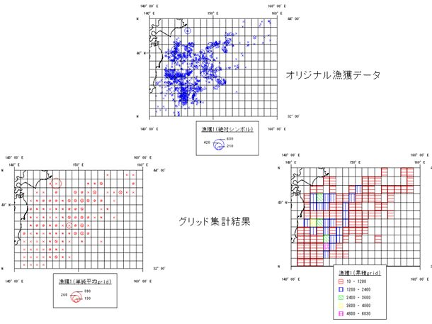
空間解析グリット集計
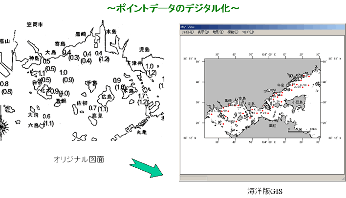
漁場環境データ入力専用ツール

ノリ・カキ等漁場環境速報
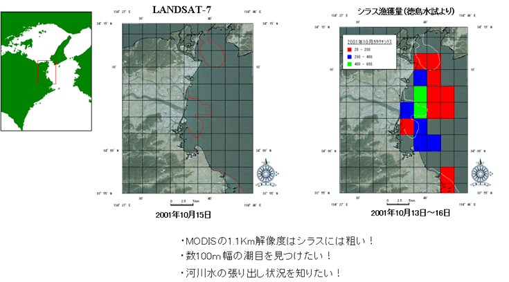
シラス漁業への衛星画像の利用
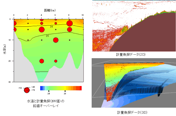
計量魚探データ
計量魚探とサイドスキャンソナーにより推定される魚群の3D表示
魚礁・藻場等の沿岸調査データの管理
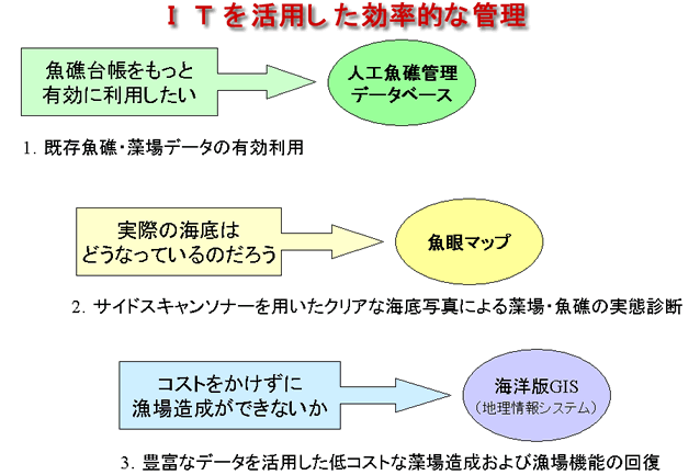
海洋版GISを利用した魚礁・藻場管理
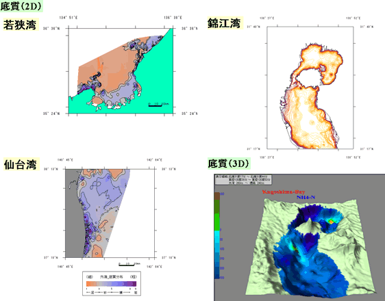
海底地形と底質分布
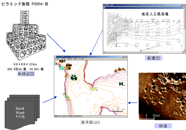
魚礁関連の図面・映像等の表示
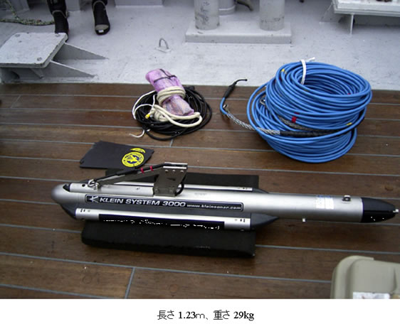
魚礁撮影のための曳航式サイドスキャンソナー
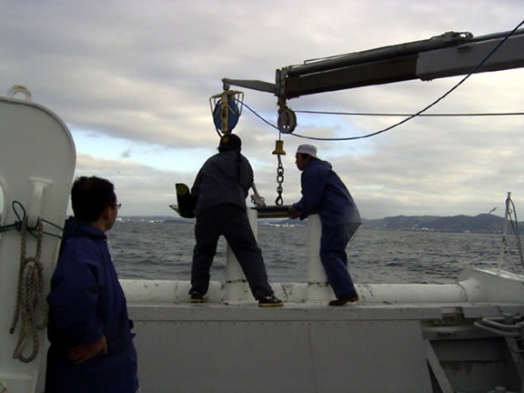
サイドスキャンソナーの投入事例
魚礁管理マップ:提供[(社)水産土木建設技術センター]
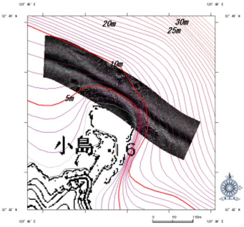
海洋版GISへのモザイク図の展開
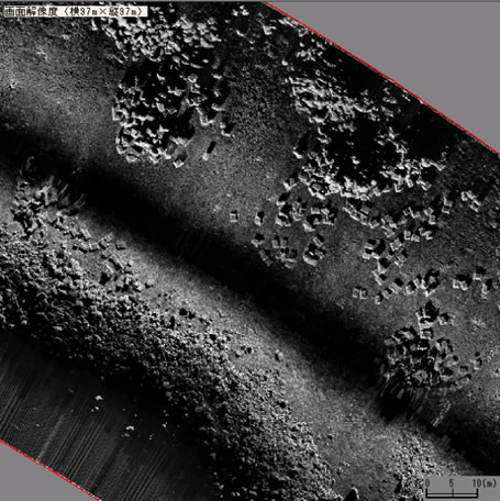
拡大したモザイク図
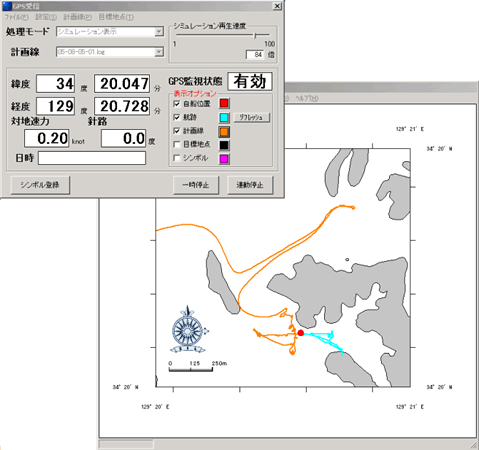
GPSとの連動した魚礁探索システム

サイドスキャンソナーによる魚礁探索事例
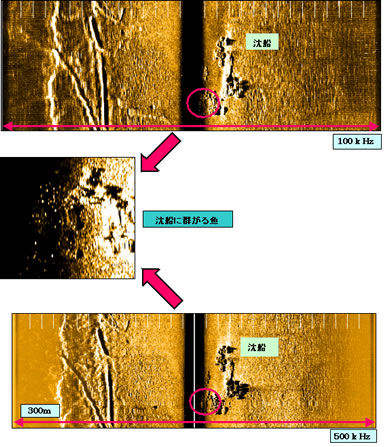
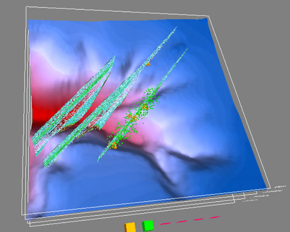
サイドスキャンソナーによる魚群の計量
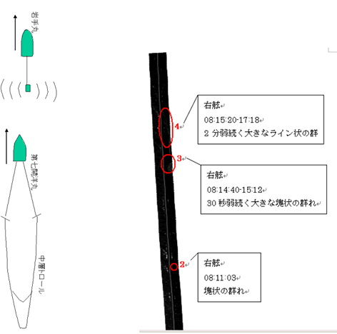
サイドスキャンソナーを用いたサンマ漁獲効率調査

サイドスキャンソナーによるサンマ群性パターン
衛星画像による漁海況情報の収集
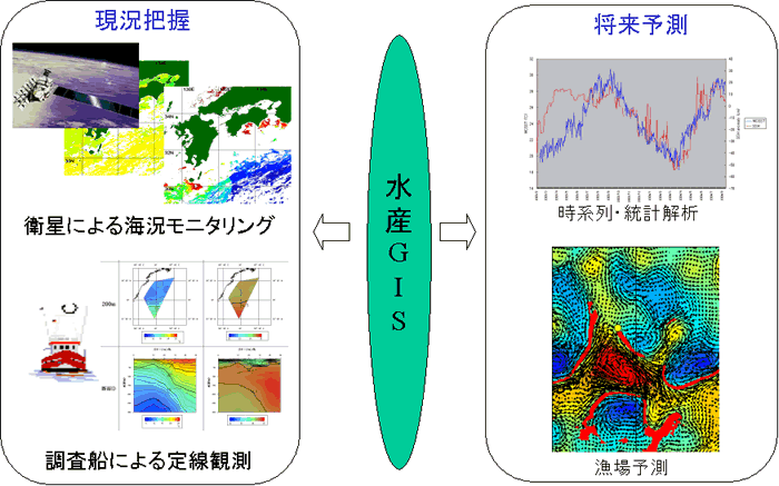
海洋版GISと漁海況予報
水産海洋における衛星データの利用
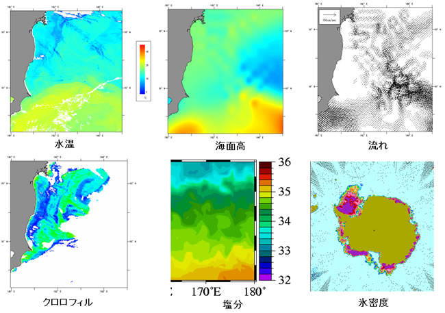
衛星画像による漁海況情報の収集

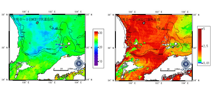
高解像度衛星画像による海況モニタリング
エチゼンクラゲ空撮のための潮目探し

遠州灘沖の海況変動

豊後水道沖における表面水温及び海面高偏差の時系列変化
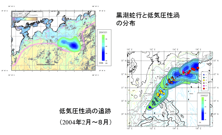
黒潮蛇行のモニタリング
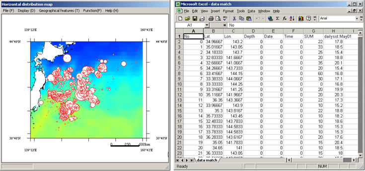
漁獲位置における海況情報の抽出
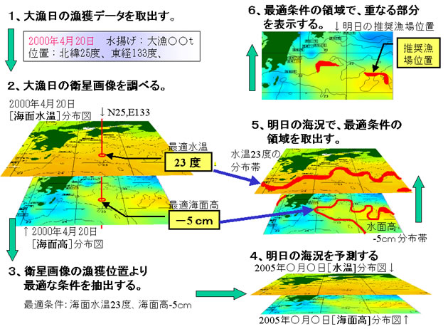
衛星データの漁場予測への利用
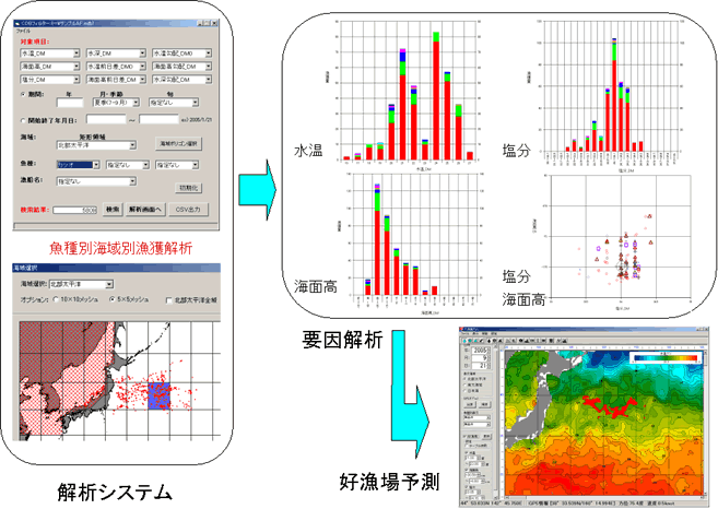
漁場形成要因の解析と好漁場予測
海底地形図作成
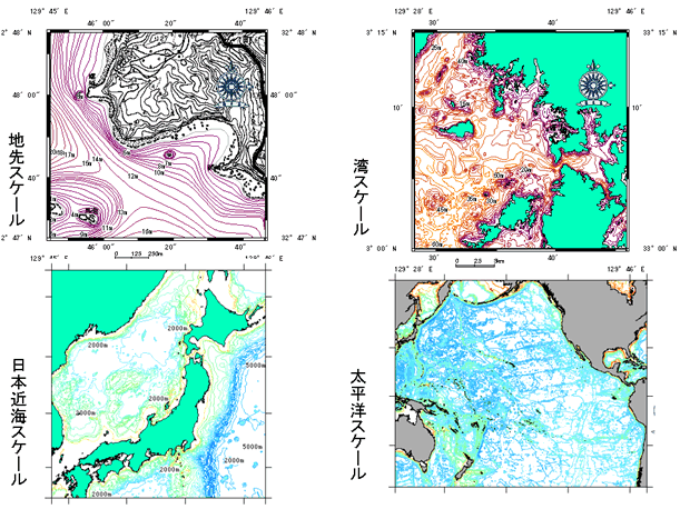
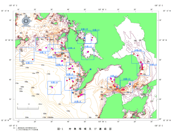
対象海域
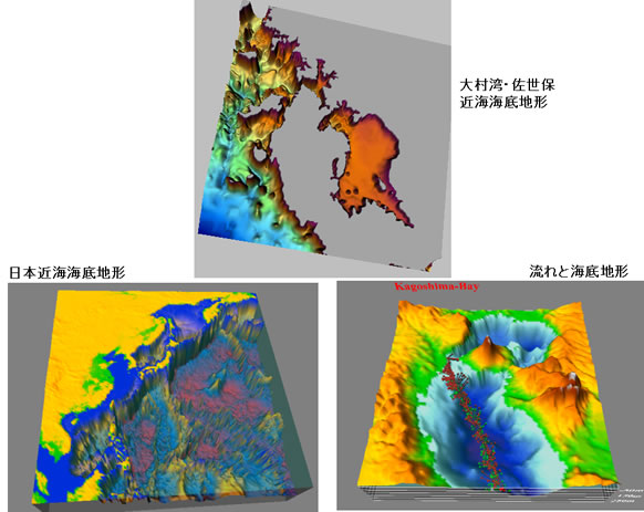
3D表示
魚探を使った海底地形図の作成
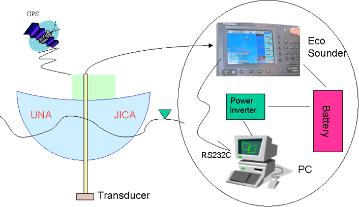
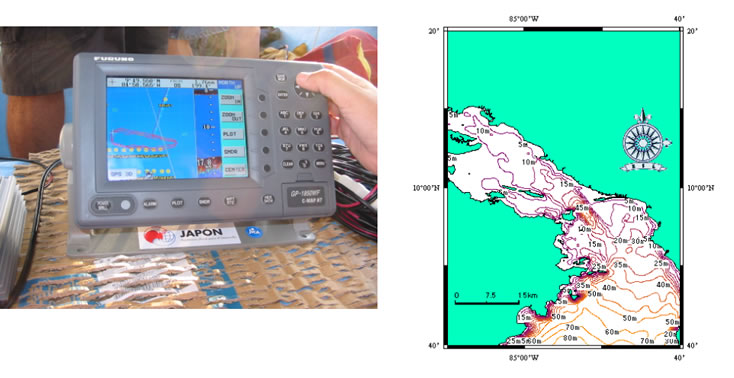
小型ボートによる簡易海底地形図作成システム
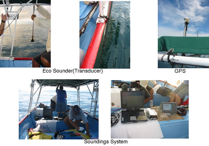
コスタリカにおける簡易海底地形図事例

岩礁地帯における海底地形作図事例(Negritos Island)
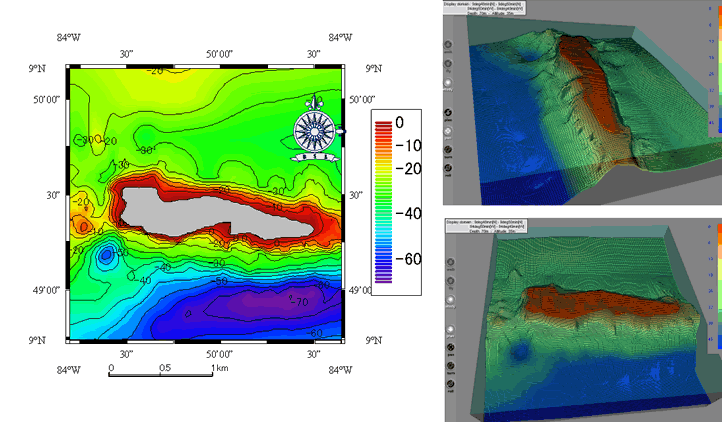
海底地形図の2・3次元表示(Negritos Island)
海洋水産資源のためのプラットフォーム
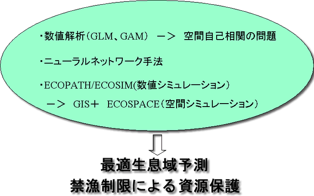
海洋版GISをプラットフォームとしたシミュレーション
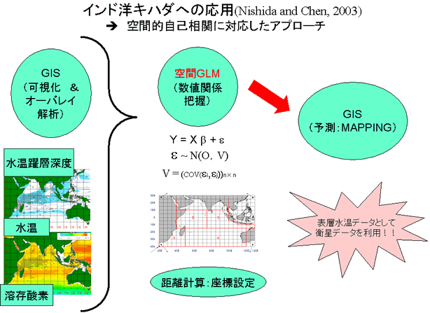
空間GLMにもとづくHSI(最適生息海域)予測
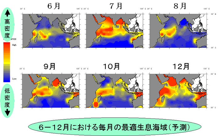
GIS→空間GLM→HSI
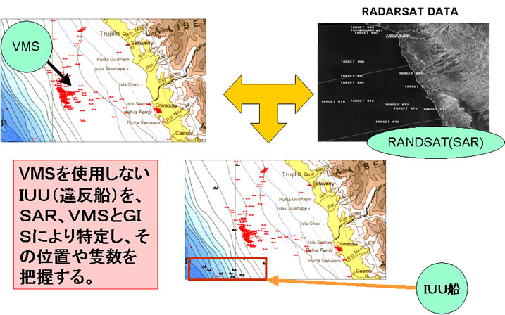
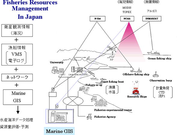
IUU(違反船)摘発のための総合的手法
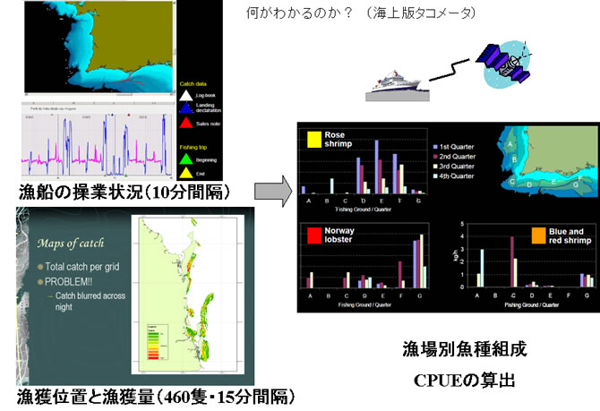
VMSと電子漁撈ログによる資源管理
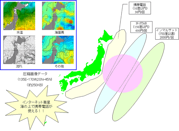
通信手段から見た漁船仕様の漁海況情報の配信
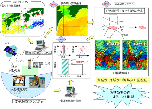
漁船データと地球観測衛星を結合した新しい漁獲システム
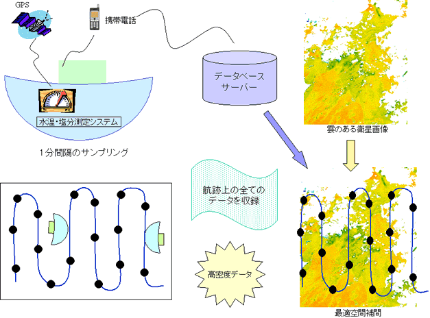
船舶を使った連続表層データの定期配信